

Benefits of using a drone for surveys

Frazer Harrison
In recent years, drone technology has transformed various industries, and one area where it has particularly excelled is land surveying. Traditional land surveying methods often involve time-consuming and labour-intensive processes, but the emergence of drones has revolutionized this field. By utilizing unmanned aerial vehicles (UAVs) equipped with high-resolution cameras and advanced sensors, drone land surveying offers a host of benefits that can significantly improve efficiency, accuracy, and cost-effectiveness.
In this blog post, we will explore the advantages of drone surveys and its transformative impact on the mapping industry.

Enhanced Efficiency and Speed
Drone survey's expedites the mapping process by providing rapid data acquisition capabilities. With the ability to cover large areas quickly, drones significantly reduce the time required to complete surveys compared to traditional methods. A drone can capture data from multiple angles and altitudes, capturing a wealth of information in a single flight. This efficiency enables surveyors to gather accurate and comprehensive data in a fraction of the time, expediting project timelines and increasing overall productivity.

High Precision and Accuracy
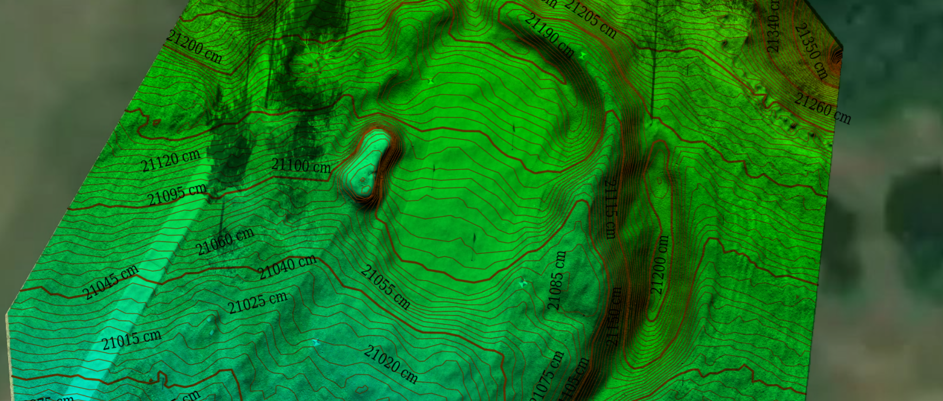
Accurate data is crucial in land surveying, and drones excel in delivering precise measurements. Equipped with advanced sensors and GPS technology, drones can capture detailed images and collect precise geospatial data. These data points can be used to create highly accurate 3D models, digital elevation models (DEMs), and orthomosaics. The accuracy of drone survey’s can benefit various sectors, including construction, infrastructure development, and environmental monitoring.

Safety and Accessibility
Traditional land surveying often involves working in hazardous or hard-to-reach locations. By employing drones, surveyors can eliminate the need for human presence in dangerous areas, such as steep terrains, unstable structures, or remote sites. This technology enhances worker safety and reduces potential risks associated with challenging surveying conditions. Additionally, drones can access areas that may be inaccessible or impractical for surveyors on foot, such as dense forests, inaccessible coastlines, or large industrial sites.

Cost-Effectiveness
Drone land surveying offers a cost-effective alternative to traditional methods. By automating the data collection process, drones require fewer personnel and equipment, reducing labour and equipment costs. The rapid data acquisition capabilities and increased efficiency of drones also minimize overall project timelines, leading to cost savings. Furthermore, the accuracy of drone survey data reduces the need for rework, minimizing expenses associated with errors or inaccuracies.

Data Visualization and Analysis
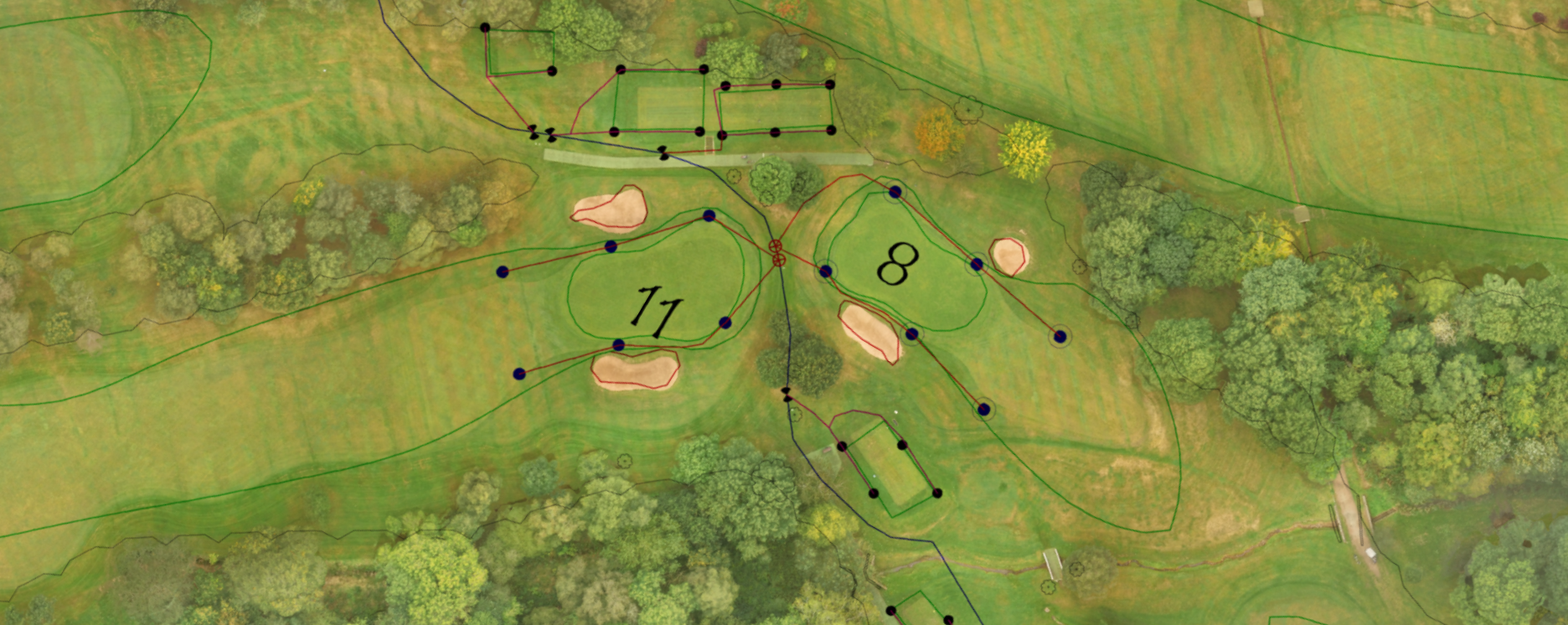
The data collected by drones can be processed and transformed into detailed maps, point clouds, 3D models, and orthophotos. These visual representations provide valuable insights for decision-making, design, and planning processes. By analyzing the survey data, stakeholders can make informed decisions based on accurate, up-to-date information. This helps in optimizing land use, identifying potential issues, and improving project outcomes.

Drone surveys have brought about a transformative change in the mapping industry, offering numerous advantages over traditional surveying methods. From enhanced efficiency and speed to improved accuracy and cost-effectiveness, drones have revolutionized how land surveys are conducted. By harnessing the power of unmanned aerial vehicles, surveyors can now collect precise data, access hard-to-reach areas, and analyze the information to make informed decisions. With the continued advancements in drone technology, the future of land surveying looks promising, paving the way for improved infrastructure development, environmental monitoring, and overall land management.